The Anza Trail
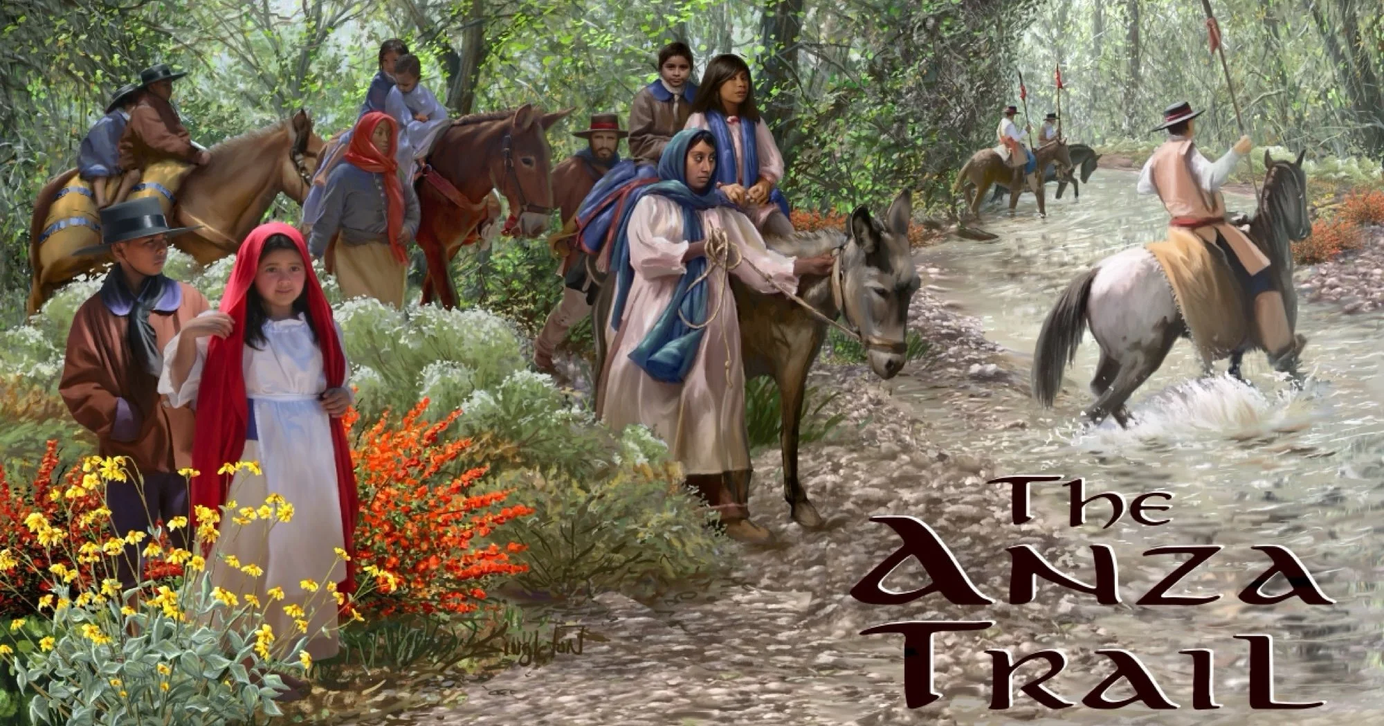
The Anza Trail: Visualizing the 1775–1776 Expedition
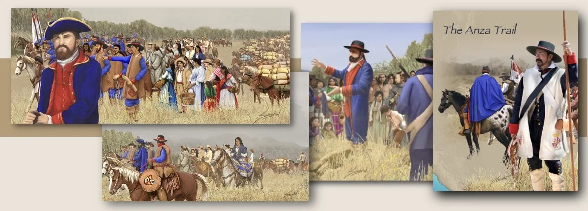
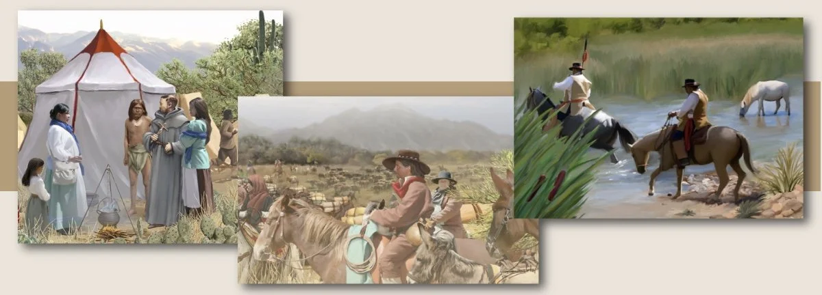
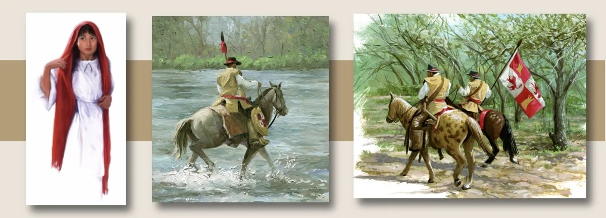
Working under commissions from the National Park Service, the Arizona Department of Transportation, and Pima County, I created 11 historic illustrations of the 1775–1776 Anza Expedition for interpretive signs placed along the modern motorized route of the Expedition as it winds through southern Arizona. I have since expanded this collection with additional pieces for the Town of Marana and the Santa Fe Ranch. Below are a few of the illustrations used for these public markers.
From the Drive-In to the Desert
Around 2001, I was commissioned by ADOT and Pima County to create an illustration for a sign at the base of Sentinel Peak depicting the 1775 Anza Expedition. Growing up in Tucson, my only reference to the name "Anza" was the local drive-in theater! As someone who leaned more toward sci-fi than historical illustration, this wasn't my usual territory. But I jumped in, began my research, and quickly realized I was uncovering a truly incredible story.
Visual Archaeology & Archival Reconstruction
What began as a single illustration evolved into an expansive process of "visual archaeology". I spoke with historians and, most importantly, connected with living descendants of the expedition. I gathered a meticulous set of references, learning about the specific Spanish horses, the livestock, and the exact clothing worn by the colonists.
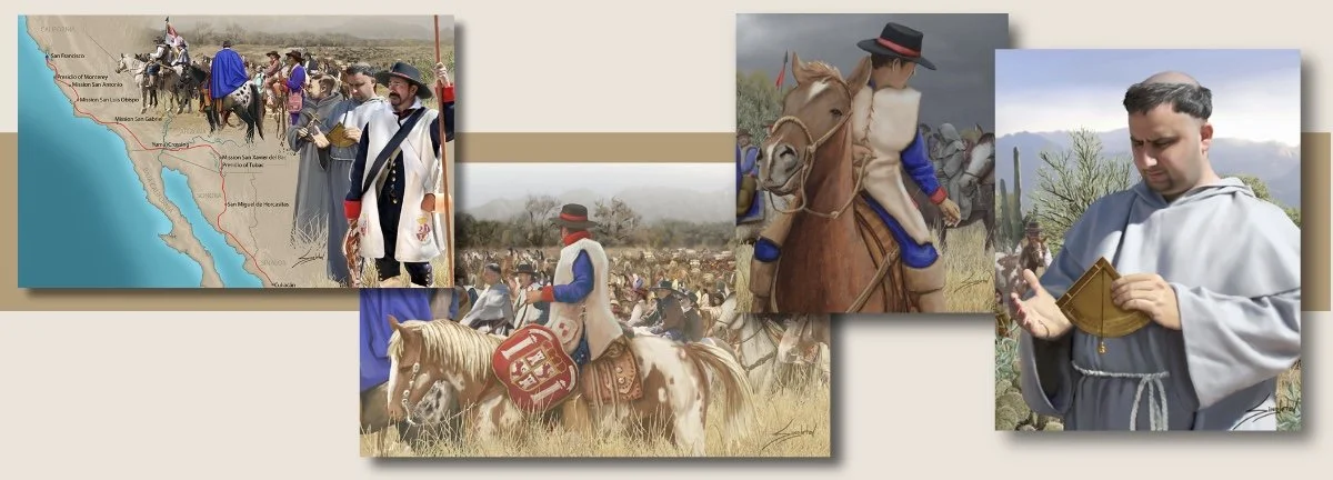
This project required me to move beyond mere drawing and into the realm of archival reconstruction. Over the course of several years, I completed over 11 signs for Pima County. During that time, my research deepened through books, historical archives, and invaluable conversations with the descendants themselves. The more I learned about Juan Bautista de Anza and how flawlessly he executed this massive logistical feat, the more deeply impressed I became with his leadership.
After the original Pima County signs, requests continued from organizations like the National Park Service, the Town of Marana, and Santa Fe Ranch near Nogales. I also illustrated an educational booklet for fourth graders commissioned by the National Park Service, which is currently used in California schools.
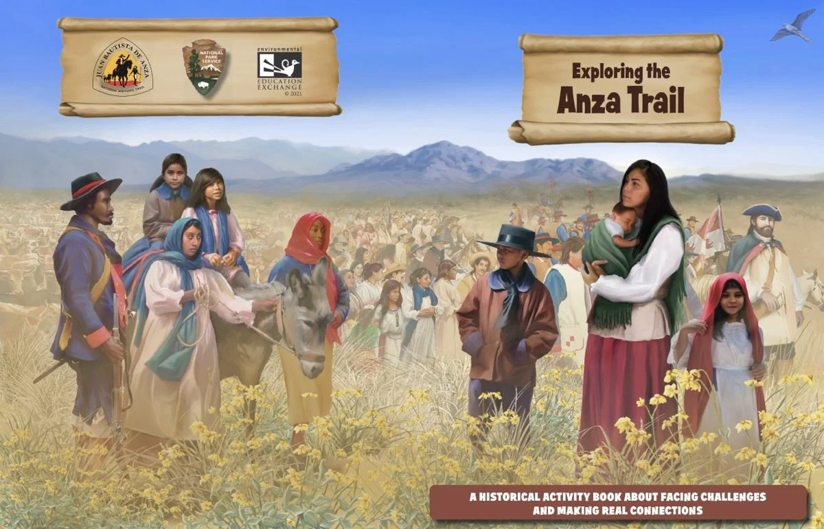
Exploring the Anza Trail – Educational Activity Book
In 2021 I created an Anza Trail activity booklet for National Park Service (NPS) in partnership with the Environmental Education Exchange
I designed and developed this comprehensive historical activity book for the Juan Bautista de Anza National Historic Trail. Centered on themes of resilience and human connection, the booklet serves as a primary curriculum tool for 3rd and 4th-grade students. Since its launch, the program has reached over 34,000 students, helping them navigate the complex history of the 1775-76 expedition through engaging storytelling and interactive challenges.
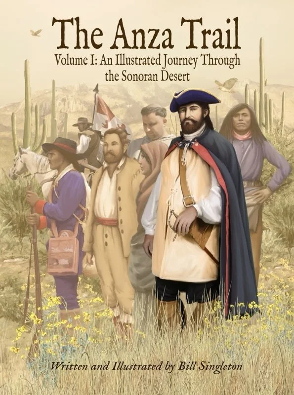
Expanding the Legacy: Upcoming Book
Today, my decades of Anza research have culminated in a comprehensive series of books that I am actively writing and illustrating. Here is the first one: The Anza Trail Volume One: An Illustrated Journey through the Sonoran Desert
Check back regularly—as soon as these books are published, I will announce and post links to purchase directly to this page!